
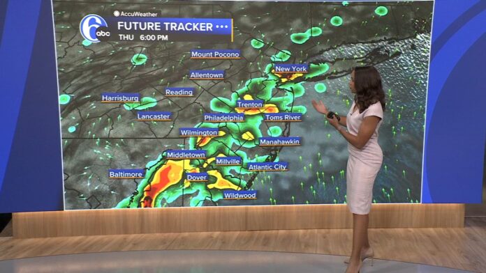

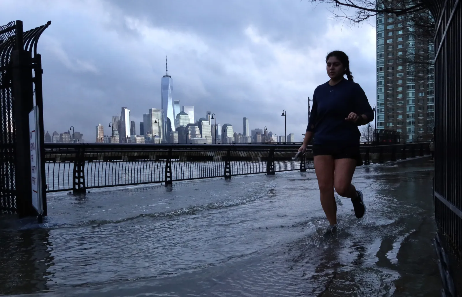
New Jersey residents finally caught their breath on Wednesday after a punishing stretch of storms battered the state earlier in the week, but that calm is proving to be little more than a pause. Forecasters are now tracking a fresh threat of strong thunderstorms and localized flash flooding set to arrive late Thursday, July 9, 2026, just as the ground across much of the state is still saturated from a system that dumped six to seven inches of rain on some communities only days earlier. For a state still drying out, the timing could hardly be worse.
Wednesday itself offered genuine relief. Skies turned mostly sunny, humidity eased into a far more tolerable range, and afternoon temperatures climbed into the mid-80s under conditions that felt, for the first time in days, like an ordinary midsummer day rather than a tropical slog. As evening set in, temperatures sat around 82 degrees with humidity near 60 percent and a gentle breeze of roughly seven miles per hour, setting up a clear and comfortable overnight with lows dipping into the mid to upper 60s. It was the kind of night that invited open windows and a break from air conditioning, though anyone paying attention to the extended outlook knew not to get too comfortable, because the atmosphere was already beginning to reload for its next act.
Current Conditions (Wednesday Night)
The current temperature is a pleasant 82°F with 60% humidity and mild 7 mph winds. Expect a clear, comfortable night with a low around 66°F to 68°F as humidity slowly starts building back up by morning.
Upcoming 3-Day Forecast
| Day | Sky Condition | Temperature | Chance of Rain |
|---|---|---|---|
| Wed, Jul 8 | 84°F / 66°F | 5% | |
| Thu, Jul 9 | 83°F / 70°F | 75% | |
| Fri, Jul 10 | 88°F / 72°F | 40% |
Detailed Hourly Timeline for Thursday’s Storms
- 8 AM – 12 PM: Mostly sunny and humid. Temperatures will climb from 73°F to 83°F. Rain risk remains very low (under 20%). [, 2]
- 1 PM – 5 PM: Storms roll in. There is a 65% to 75% chance of heavy thunderstorms during these hours. Pockets of heavy rain could quickly drop 1 to 2 inches of water, renewing flash flood risks.
- 6 PM – Nighttime: Scattered lingering storms and light rain will continue into the evening with a 35% to 40% chance of precipitation, eventually leaving behind cloudy skies overnight.
The threat of scattered afternoon thunderstorms remains active into Friday before the state finally breaks into a clearer, dry weekend. Check out local updates on NJ.com Weather or track live radar on News 12 New Jersey to monitor flood advisories in your specific county.
That next act arrives Thursday, and it arrives with real teeth. Meteorologists tracking the pattern describe a weak area of low pressure that had been parked over the Mid-Atlantic region, the same system responsible for this week’s earlier flooding, now drifting offshore to sit just south of Cape Cod. As it pulls away, it leaves behind a northerly flow across New Jersey that has been holding temperatures down and clearing out the worst of the storm activity, even as dew points remain stubbornly high and keep the air feeling heavier than the thermometer alone would suggest. Rather than a true cold front sweeping down from Canada, this brief cooldown has behaved more like a naturally occurring cooler pocket within a broader, still-humid air mass blanketing the eastern United States, which explains why Wednesday felt pleasant but never quite crisp.
Thursday will start harmlessly enough. Morning hours should stay mostly sunny and warm, with temperatures climbing steadily from the low 70s toward the low 80s and only a slim chance of rain through midday. That changes dramatically once the afternoon arrives. Between roughly one and five o’clock, forecasters are calling for a 65 to 75 percent chance of thunderstorms moving through the region, some of which could be capable of dropping one to two inches of rain in a short window, a rate more than sufficient to overwhelm already-saturated soil and trigger renewed flash flood concerns in low-lying and flood-prone areas. High temperatures Thursday should top out near 83 degrees, with overnight lows settling around 70, and the humidity building back in as the day progresses will make the atmosphere feel considerably more oppressive than Wednesday’s brief window of comfort. As evening arrives, the most intense storm activity should begin to taper into scattered lingering showers and lighter rain, with a 35 to 40 percent chance of precipitation continuing into the night before skies turn cloudy and calmer heading into the overnight hours.
Friday will carry some of that unsettled energy forward, though in a milder form. Expect a warmer day overall, with highs reaching into the upper 80s and a roughly 40 percent chance of lingering light rain and scattered afternoon thunderstorms rather than the more organized, heavier activity expected Thursday. It is not until the weekend that New Jersey should finally see a more decisive break, with drier and clearer conditions returning as the pattern resets.
Understanding why this week has felt like an unrelenting parade of storms requires looking beyond the day-to-day forecast and into the broader atmospheric setup driving it. Meteorologists have been watching what is sometimes referred to within forecasting circles as a death ridge, or ring of fire pattern, in which a dome of high pressure anchors itself over one part of the country while thunderstorms repeatedly fire along its northern and eastern edges. Last week, that ridge centered over the Great Lakes, funneling intense heat and humidity up from the southeastern United States into the Mid-Atlantic and pulling New Jersey into the fringe of that storm corridor as the pattern matured. Now, meteorologists are tracking a similar ridge reforming, but this time centered farther west, closer to the Dakotas rather than the Great Lakes. That shift should spare New Jersey from the most extreme heat associated with the ridge’s core, but it does not spare the state from its storm track. Thunderstorms that develop in the hottest sector of this new ridge are likely to get steered eastward across the Great Lakes, picking up additional moisture along the way, before arriving in New Jersey as larger clusters of storms known as mesoscale convective systems. Under the right conditions, these clusters can organize into long, bowing lines of storms capable of producing widespread damaging winds, the same broad category of event that produced New Jersey’s derecho back in June of 2012. True derechos remain rare, and there is no indication yet that this setup will reach that threshold, but the ingredients in play are enough that forecasters are treating the period from July 13 through 16 as one worth watching closely for another round of potentially damaging thunderstorm activity.
For now, the practical guidance for New Jersey residents is straightforward. Wednesday night should remain comfortable and dry, a good opportunity to get outside or catch up on any outdoor plans postponed by the earlier storms. Thursday’s window of greatest concern falls squarely in the afternoon and early evening, when heavy downpours, frequent lightning, and gusty winds strong enough to topple patio furniture, scatter loose yard items, or snap small tree limbs are all realistic possibilities. Anyone in flood-prone neighborhoods or areas that saw significant rainfall earlier this week should pay particular attention to Thursday afternoon, since it will not take much additional rain to overwhelm ground that has had little time to absorb what has already fallen. Friday should bring a somewhat gentler version of the same pattern before the weekend finally delivers sustained relief, with highs holding in the 80s, overnight lows in the 60s, and only the ordinary, garden-variety chance of a passing afternoon storm rather than anything more severe.
Looking further ahead, the broader message for New Jersey this July is one of rhythm rather than a single isolated event. The state appears to be settling into a recurring cycle of humid buildup followed by rounds of thunderstorms, punctuated by brief, welcome breaks like the one enjoyed on Wednesday. With another potentially active stretch already being flagged for the middle of next week, residents would be wise to stay weather-aware, keep an eye on evolving forecasts, and treat any break in the pattern as exactly what it is: a pause, not a finish line.
















