New Jersey residents are bracing for a sizzling end to the week, coupled with an Atlantic system that’s worth keeping an eye on. As temperatures climb and humidity sticks like a second skin, a developing tropical system—Erin, forming off the Western Verde region—is slowly making its way across the Atlantic, stirring questions about whether the Garden State might feel its presence in the days ahead.
Midweek Heat and Humidity
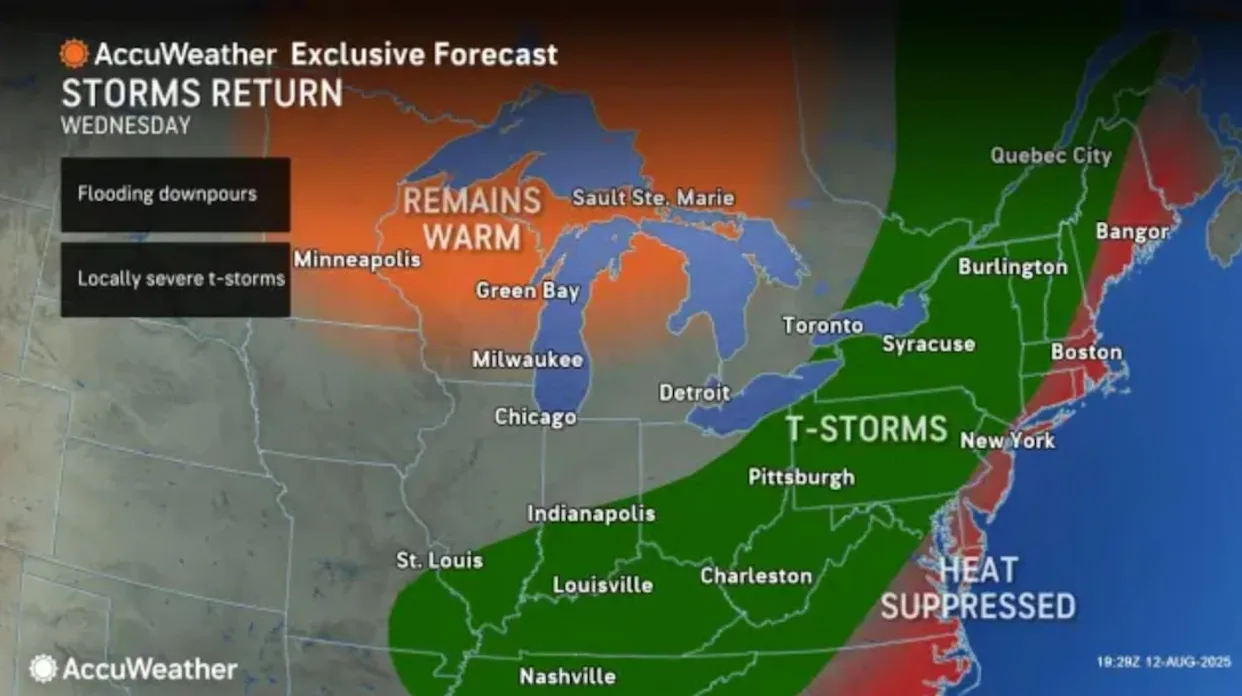
Wednesday is shaping up to be the hottest day yet, with highs pushing into the upper 80s and near 90 for many across the state. The sun will shine for much of the day, but afternoon thunderstorms are possible, lingering into the evening and overnight hours. Thursday cools just slightly but remains humid, with scattered storms likely, keeping umbrellas close at hand. By Friday, temperatures rebound again, combining warmth and humidity with more settled skies and a lower chance of storms—a brief reprieve before the weekend.
The weekend itself looks like a classic East Coast summer: hot, sticky, and generally storm-free except for isolated pop-up showers along sea breeze fronts. For beachgoers and boaters, conditions are mostly favorable, though strong rip currents along both the northern and southern New Jersey shorelines are a concern due to persistent onshore winds. Staying hydrated and seeking shade when possible will be key to navigating the heat safely.
For ongoing updates on the state’s weather, check out Explore New Jersey Weather Report.
Tracking Erin: The Atlantic’s Tropical Question Mark
Out over the Atlantic, a tropical system named Erin is emerging from the Western Verde region. Meteorologists are watching its trajectory closely, as it will largely determine potential impacts on the Northeast. While Erin is still forming and relatively weak, the system’s movement over colder waters and dry air has tempered its immediate strength, causing some adjustments in forecast tracks.
To understand how Erin might—or might not—affect New Jersey, think of the Garden State as a perfect bowling strike. A storm system, especially one like Erin, is a less consistent bowler: lots of gutter balls, some curves, occasional near misses. For context, New Jersey hasn’t experienced a direct hurricane hit in over a century. Iconic storms like Hurricane Sandy (2012) and Irene (2011) were downgraded before landfall, while others, like Gloria in 1944, largely grazed the coast. For Erin, the probability of a “perfect strike” is low, but it remains possible.
Current Predictions
The latest trends show Erin maintaining a weaker profile, meaning its initial track may stay closer to the northeast Caribbean islands rather than curving sharply north. If the system strengthens in the coming days, it’s more likely to curve out to sea, avoiding land impacts along the U.S. East Coast. Conversely, a sustained weaker storm could bring it closer to the Leeward Islands, setting up a potential—but still distant—threat to the U.S. by next week.
Meteorologists are also watching the Bermuda High, which will shift toward the Azores over the weekend. This high-pressure ridge could influence Erin’s steering currents, guiding it northward along the eastern edge of the ridge that sits over the southeastern U.S. The timing of this northward curve is critical: an early shift sends Erin out to sea, while a later turn could brush the Outer Banks, Delmarva, or even New Jersey with fringe effects.
Probabilities and Planning
Based on current observations, there’s roughly:
- 10% chance Erin remains weak, moving into the Caribbean and missing the U.S. entirely.
- 70% chance the system curves out to sea, posing minimal direct impact.
- 30% chance of fringe or secondary impacts somewhere from Florida to Cape Cod, with a very low single-digit chance of New Jersey experiencing significant effects.
Even with these probabilities, meteorologists emphasize that much can change in the next few days. Erin’s strength and path will become clearer once it approaches the northeast Caribbean and lesser Antilles islands, offering a better forecast window for next week.
Bottom Line for Garden State Residents
For now, the focus remains on the immediate weather. Hot, humid conditions dominate through the weekend, with midweek thunderstorms providing the main disruption. Beach trips, boating, and outdoor activities are largely favorable, but awareness of rip currents and staying hydrated is crucial. Meanwhile, Erin is the system to watch next week, a reminder that the Atlantic is always capable of surprises.
Stay tuned for updates and track developments in real time at Explore New Jersey Weather Report.


