New Jersey is facing the brunt of a powerful nor’easter sweeping across the state this Sunday, October 12, 2025, prompting Acting Governor Tahesha Way to issue a state of emergency for all 21 counties. The fast-moving system has unleashed strong winds, torrential rain, and severe coastal flooding, leaving thousands without power and prompting urgent safety warnings from state officials and emergency responders.

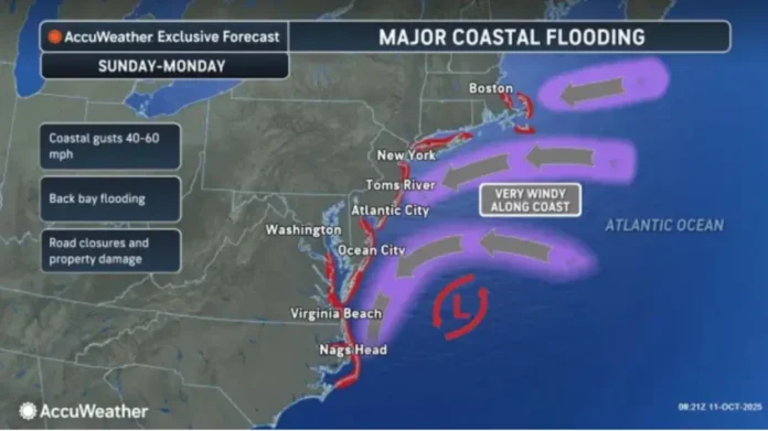
From Cape May to Sussex County, the storm’s impact has been felt statewide. Winds gusting up to 60 miles per hour have battered homes, uprooted trees, and downed power lines, while unrelenting rainfall has led to flash flooding in several inland communities. Along the Jersey Shore, the combination of strong onshore winds and astronomical high tides has created dangerous storm surge conditions that could rival some of the worst coastal flooding events in recent years.
Utility crews across New Jersey are working around the clock to restore power to affected homes and businesses. Thousands of residents served by JCP&L, PSE&G, Atlantic City Electric, and Rockland Electric have already experienced outages, with more expected as the storm continues into the evening. Officials urge residents to stay indoors and report any downed wires immediately, as high winds continue to pose a hazard to both workers and the public.
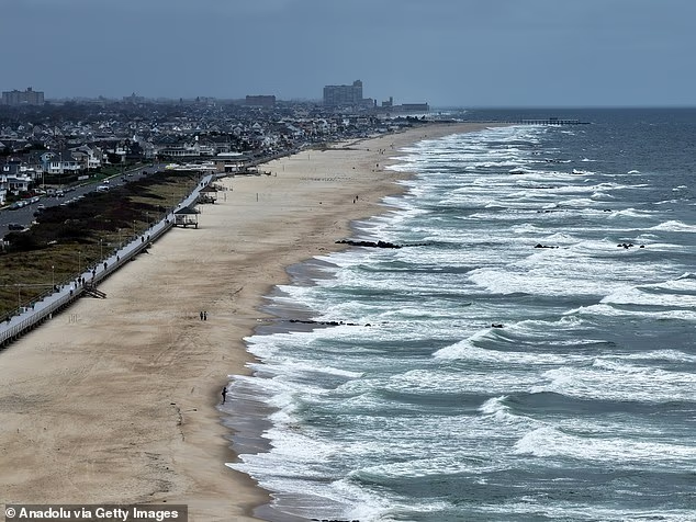
Coastal towns are among the hardest hit, with forecasters warning that moderate to major flooding could persist through multiple tide cycles. Communities such as Seaside Heights, Belmar, Long Beach Island, and Atlantic City are facing significant flooding in low-lying areas, while coastal erosion is rapidly reshaping beaches and dunes. Local emergency management teams have begun precautionary evacuations in flood-prone zones, with shelters prepared to accommodate displaced residents if conditions worsen overnight.
Rainfall totals are expected to reach between three and five inches across most of the state, with localized areas seeing even higher amounts. Meteorologists note that the system’s slow movement increases the risk of flash flooding, particularly in central and northern counties where storm drains and smaller rivers could quickly overflow. Drivers are urged to avoid flooded roadways, as even a few inches of moving water can be deadly.
Inland regions are not spared from the storm’s reach. Wind gusts are toppling branches and debris onto roadways from Trenton to Morristown, and numerous communities have reported hazardous travel conditions. Public works departments are clearing storm drains and removing fallen trees as fast as conditions allow. State transportation officials are advising against unnecessary travel until the storm begins to taper off late Sunday night into early Monday morning.
Acting Governor Way’s state of emergency empowers local governments and first responders to access additional resources and coordinate recovery efforts. The governor urged New Jersey residents to take the storm seriously, emphasizing that the combination of high winds, flooding, and power outages presents a serious threat to public safety.
“This storm is hitting every corner of New Jersey,” Acting Governor Way said in a statement. “We need everyone to use caution, stay off the roads, and allow emergency crews to do their jobs safely. Our priority is protecting lives and ensuring communities have the support they need.”
As the nor’easter continues to churn offshore, forecasters expect the heaviest rain to subside overnight, though strong gusts and coastal flooding will likely persist through Monday’s high tides. Residents in vulnerable coastal areas are being urged to monitor local alerts and remain prepared for possible evacuation orders.
New Jersey’s storm preparedness and response systems have improved significantly in recent years, with lessons learned from previous weather disasters. Emergency shelters, utility response teams, and transportation agencies are all coordinating closely to manage the storm’s effects and begin recovery operations as soon as conditions allow.
For ongoing coverage, storm updates, and local weather forecasts across the Garden State, visit Explore New Jersey’s Weather Report.


