New Jersey, with its diverse landscapes stretching from the northern mountains to the southern shores, offers a unique weather experience, especially as we transition into the full swing of summer. This week, we’re seeing the typical interplay of atmospheric forces that keep things interesting, from warmer, more humid days to the possibility of pop-up thunderstorms. For anyone planning their outdoor activities or just curious about what the skies have in store, keeping an eye on the forecast is always a good idea. And for all the latest updates on New Jersey’s fascinating weather patterns, you can always check out our dedicated weather report section.
The Jet Stream’s Dance: A Week of Shifting Conditions
The upper jet stream, a powerful river of air high in the atmosphere, is poised just north of New Jersey this week. This position aligns with a near-zonal flow pattern, generally meaning west-to-east winds and more consistent temperatures. However, a developing upper-low pressure system to our northwest, lifting into southeastern Canada, will introduce some variability. While the majority of New Jersey is expected to bask in warmer temperatures, higher elevations in the northwestern part of the state might catch a refreshing graze of cooler air as the system skirts by.
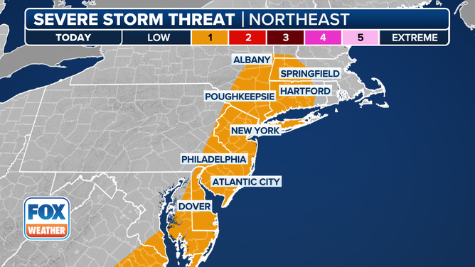
Overall, the week promises a build-up of warmth and humidity from Wednesday through Friday, bringing with it the familiar summer possibility of scattered showers and thunderstorms. If you’re looking for the quintessential clear, sunny, and less humid day, Wednesday (June 11) appears to be your best bet. Keep an eye out for potential high-altitude haze during this period, which can sometimes drift in from wildfires upstream.
As the weekend approaches, the forecast suggests a slight step back, with cooler temperatures and an increased chance of rain returning. While this might be a bit of a dampener for some outdoor plans, it’s a necessary part of maintaining the state’s ecological balance.
A Day-by-Day Snapshot: What to Expect This Week (June 9-15, 2025)
Monday (June 9): Kicking off the week, high temperatures across the state are generally in the 60-75°F range, with southwestern New Jersey seeing the warmest conditions. Expect mixed skies, mostly cloudy with brief sunny intervals, and the occasional drizzle. While the evening should offer a break from precipitation, isolated showers and thunderstorms could develop overnight. Light winds from the east/northeast will keep things gentle, with overnight lows settling into the 60-65°F range for most areas.
Tuesday (June 10): A noticeable warm-up is on the cards today, with most of New Jersey reaching well into the 70s°F. Skies will remain mixed, and there’s a higher chance of showers and thunderstorms. Humidity levels will stay elevated. Light westerly winds will prevail. As night falls, temperatures will drop to the 55-65°F range from north to south, signaling improving conditions as we head into Wednesday morning.
Wednesday (June 11): This is the day to enjoy the outdoors! Expect low-to-mid 80s°F across most of the state, accompanied by mostly sunny skies and noticeably less humidity. As mentioned, some high-altitude haze from distant wildfires might be visible, but it shouldn’t significantly impact air quality. Light west/southwesterly winds will contribute to the pleasant conditions. Overnight lows will once again range from 55-65°F under clear skies.
Thursday (June 12): The warmth continues to build, with temperatures reaching the mid-to-upper 80s°F across much of New Jersey. Coastal areas will likely remain a bit cooler, closer to 80°F. Generally, expect mostly sunny and hazy skies with increasing humidity. Afternoon and evening hours could see pop-up showers and thunderstorms. Light west/southwesterly winds will persist, and overnight lows should stay above 60°F as the humidity lingers.
Friday (June 13): Get ready for widespread well-into-the-80s°F temperatures. Skies will be mostly sunny and humid, with a continued chance of pop-up showers and thunderstorms in the afternoon and evening. Light easterly winds will be present. Overnight lows will fall back to the 55-65°F range, with showers and thunderstorms possible into Saturday morning.
Early Weekend Outlook (June 14-15): The weekend looks to bring a slight cool-down, with highs closer to 70°F and more unsettled conditions. Sunday is currently shaping up to be the better day for outdoor activities, offering a potentially clearer window.
While the return of occasional weekend rain might be a bit frustrating for those eager for consistent sunshine, it’s a vital part of New Jersey’s climate, ensuring that the state remains vibrant and green. The recent subsidence of drought conditions is certainly a welcome development. As always, stay safe, enjoy the warming weather, and be sure to check our latest weather updates at https://explorenewjersey.org/category/weather-report/ before you step out!


