New Jersey soaked up another picture-perfect autumn afternoon on Monday, with bright skies and temperatures settling comfortably in the upper 50s. The state has enjoyed a remarkable stretch of crisp fall weather, but the mood in the atmosphere is shifting fast as an impactful storm pattern begins to build. For ongoing statewide weather developments, stay connected here: https://explorenewjersey.org/category/weather-report/
The first sign of change arrives Tuesday as clouds thicken and winds gradually strengthen from the northeast, especially along the Jersey Shore. A small offshore system passing well to our southeast will tighten pressure against high pressure to the north, stirring up gusty breezes near the coast — possibly approaching 40 mph from late Tuesday into Wednesday. Most of New Jersey remains dry through daytime Wednesday, though a few stray showers could sneak into far southern coastal areas.
The main weather maker takes center stage Wednesday night through Friday morning. A strong upper-level trough is digging into the eastern United States, and all major forecasting models agree that a developing low-pressure system will swing toward the Mid-Atlantic. This isn’t expected to stall offshore nor develop into a full-blown nor’easter, but a southern-born storm traveling up through the Carolinas toward Pennsylvania will pack plenty of muscle by the time it reaches New Jersey.
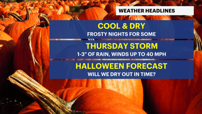
Rain is expected to overspread the state after midnight Wednesday night, hitting its stride throughout Thursday. Widespread totals between three-quarters of an inch and an inch and a quarter appear most likely, though any enhanced banding could push localized amounts closer to two inches. Nothing suggests extreme flooding at this time, but gutters, drains and low-lying spots should be watched closely as the day unfolds.
Wind is also part of the equation. Gusts around 30 mph will be common statewide, with occasional bursts closer to 40 mph possible in exposed areas. The storm’s wind peak is forecast from Thursday morning into the afternoon as the system races northward. Roads could see scattered leaf-clogged puddles and tricky travel for high-profile vehicles.
The good news arrives just in time for Halloween celebrations. Rain is expected to pull away early Friday morning with improving conditions through the day. A brisk west-northwest wind will help dry things out for evening trick-or-treat plans, although it will come with a noticeable chill. Jackets will be a smart addition to any costume; candy bags may even double as hand warmers.
The atmosphere remains energized even after the storm exits, with cooler air filtering in behind the system and breezy conditions persisting Friday afternoon. Those planning outdoor festivities might feel more like late November than late October, but at least umbrellas can stay home.
New Jersey’s scenic fall stretch had to end sometime, and the atmosphere chose Halloween week for maximum drama. Residents should prepare for a blustery, rain-filled Thursday followed by a crisp, dry and spirited Friday night. Keep checking updated forecasts across the Garden State at https://explorenewjersey.org/category/weather-report/ as New Jersey moves from autumn calm into seasonal excitement.


