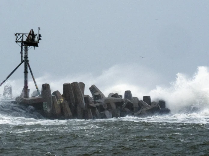
New Jersey residents along the coast experienced the height of a persistent nor’easter this past Monday, with sustained winds, coastal flooding, and steady rainfall making for challenging conditions. While the system’s intensity never reached the extremes of more severe storms, its slow movement and prolonged presence created a notable impact on the beaches and waterways from Southern to Eastern New Jersey.
Meteorologists tracked a coastal surface low off the Southern New Jersey and Delmarva region, hovering near 1008-1006 millibars. While not a particularly powerful storm in terms of pressure, its extended presence and occasional wobbling near the shoreline caused consistent wind and water effects over multiple high tides. Peak gusts were recorded early Monday morning, with Barnegat Inlet reaching 67 mph and Island Beach State Park recording 62 mph. Most coastal locations experienced gusts between 55-59 mph during the overnight period, while northern New Jersey felt more moderate conditions, typically in the 20-30 mph range. Winds gradually decreased throughout Monday afternoon, continuing to ease overnight into Tuesday.
Rainfall totals were heaviest along the eastern and southern coasts, particularly in Ocean County, where accumulations reached 1.5-2.5 inches, with expectations for totals climbing to 2-3 inches by Tuesday morning. Residents inland and in northern regions of the state received far less precipitation, often less than a quarter of an inch. The persistent easterly winds amplified coastal concerns, particularly during the sequence of high tides over the weekend and Monday. The third high tide, occurring Monday afternoon, posed the most significant flooding threat as water from prior tides had limited drainage capacity and battled against the incoming surge. Officials reported that conditions gradually improved following this final high tide, with water levels tapering overnight.
While the nor’easter brought significant coastal impacts, conditions are expected to improve steadily through Tuesday, transitioning to drier and cooler weather from Wednesday through Friday. The weekend promises moderated temperatures and calmer conditions, providing relief after a challenging start to the week. Forecasters note that these cooler trends are early indicators of the approaching winter season, with snowfall potential for northwest and northern New Jersey likely within the next four to eight weeks.
Residents are encouraged to remain cautious along shorelines during high tide periods, particularly in areas historically prone to flooding. Despite the storm’s eventual departure, it highlighted the vulnerabilities of New Jersey’s coastlines to slow-moving nor’easters, even those with modest central pressures.
For ongoing updates on New Jersey weather conditions, storm advisories, and future forecasts, visit Explore New Jersey Weather Report.


