August 2025 closed out slightly cooler than average across New Jersey, with temperatures running roughly 2 to 4 degrees below seasonal norms. While the month featured a few isolated heat waves, much of the period was characterized by mild, warm days and cool, dry nights—a rare stretch of late-summer comfort. Meteorologists attribute these conditions to a persistent series of upper-level troughs sweeping through the region, allowing Canadian air to filter southward, moderating daytime highs while keeping humidity low. Overnight lows frequently dipped into the 40s and 50s, producing mornings that felt more like mid-to-late September than early September.
As we moved into early September, transient warm conditions have returned. Friday, September 5, saw highs climbing into the mid-to-upper 80s along the I-95 corridor, with select locations briefly reaching 90 degrees. Northern New Jersey elevations and coastal communities experienced cooler highs in the mid-70s to low 80s. Humidity has risen, particularly in southern parts of the state, resulting in localized heat indices just above 90. Skies were mostly clear, with a steady south-southwest breeze, especially along the coast, and overnight lows settled between 65 and 70 degrees, maintaining a lingering humid feel into Saturday.
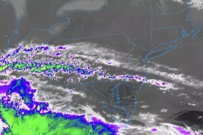
Saturday, September 6, brings a mix of sun and clouds, with similar high temperatures: upper 80s along the central corridor and roughly 80 degrees along the immediate coast and elevated northern locations. The morning will start breezy and humid, but showers and thunderstorms are expected from midday onward, especially in northwest New Jersey. Pre-frontal lifting combined with a developing coastal low offshore will create scattered instability, though brief periods of sinking air may temporarily inhibit precipitation. Afternoon through evening into the overnight hours is the most likely window for widespread storms, with overnight lows dropping to 55–65 degrees statewide.
Sunday, September 7, marks the arrival of a cold front that will restore cooler and drier conditions. Morning may remain breezy with residual rain, but skies should improve throughout the afternoon. Highs will generally reach the mid-70s, and winds shifting to the northwest will drive overnight lows back into the 40s and 50s across most of the state, reintroducing the crisp, comfortable air reminiscent of early fall.
Looking ahead to the week of September 8–12, New Jersey is expected to enjoy near-ideal conditions. Daytime temperatures away from the ocean should remain in the low-to-mid 70s, while coastal communities could see highs in the mid-to-upper 70s. Humidity will stay low, creating pleasant mornings and evenings, and the forecast currently indicates a continuation of this tranquil pattern into the following weekend. Forecasters are keeping an eye on a developing tropical system in the Lesser Antilles (Invest 91L), but at present, there is no anticipated impact on New Jersey weather. Updates will be provided as conditions evolve.
This early September weather pattern highlights the state’s transition from the heat of summer to the crisp days of fall. Residents and visitors alike can enjoy outdoor activities, low humidity, and cooler nights before the return of typical seasonal storms. For ongoing updates and forecasts for all New Jersey regions, click here.


