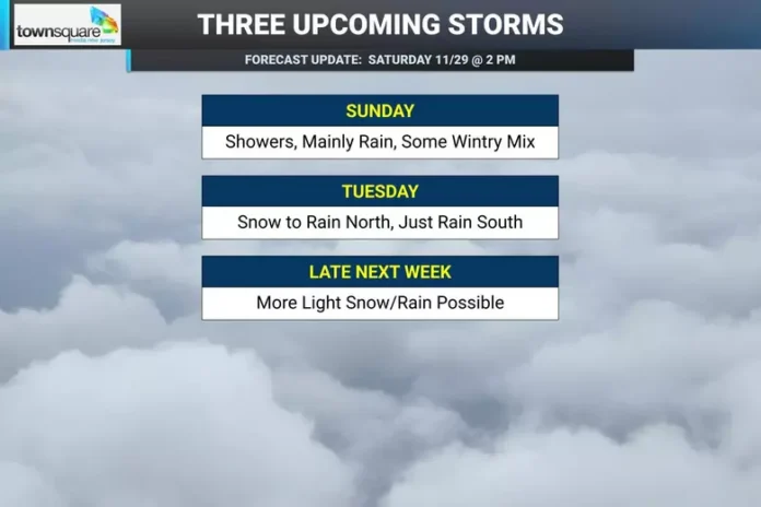
A fast-moving early December system is setting its sights on northwestern New Jersey this Tuesday, and while this won’t be a winter storm that shuts the state down, it has enough punch and complexity to bring a few inches of snow to higher elevations and slow travel in parts of the region. The setup is classic early-season New Jersey weather: plenty of cold air close by, marine influence just offshore, and a storm track that leaves a very slim margin between accumulating snow and cold rain.
This comes after a weekend marked by chilly, quiet conditions Saturday night followed by a brief period of light rain on Sunday. That weak rainmaker isn’t the main event—it simply helps drag a cold front through the state, setting up colder temperatures by Monday. For most of New Jersey, Sunday stays too warm for anything more than a few stray flakes in the northwest hills, but the real story begins after the front clears.
By Monday, two separate pieces of energy moving from west to east begin merging as they approach the East Coast. Once they combine, they’ll spin up a weak coastal low somewhere between the Delmarva region and the Outer Banks. From there, the system is expected to drift just off the New Jersey shoreline on Tuesday, though there is still wiggle room in the exact path. A shift closer to the coast or farther toward the benchmark point offshore will determine how much snow reaches areas northwest of the I-95 corridor.
Forecast confidence is high that a snow event will occur—but the challenge lies in how much sticks. New Jersey has several factors working against widespread accumulation. The heaviest precipitation is expected during the warmest stretch of the day, likely late Tuesday morning through the afternoon, which limits the ground’s ability to hold snow even in colder spots. Early December climatology also plays a role; while temperatures will be below average, daytime highs in major I-95 cities typically reach around 50 degrees this time of year. And with ocean temperatures still in the mid-40s to low-50s, any onshore flow will warm the coastal plain and push the rain line farther inland.
Because of this combination, snowfall will be wet and heavy, with low ratios that lean closer to slush than powder in many locations. Current projections place the initial snow-rain boundary near the I-95 corridor before it lifts north toward the I-78/I-287 region, possibly reaching I-80/I-287 before settling back south again toward the end of the event. Any slushy buildup across central and northeastern New Jersey will likely wash away as the system flips those areas to plain rain.
The best opportunity for measurable accumulation rests squarely in northwestern New Jersey—particularly the higher elevations of Sussex, Warren, Morris, and Passaic counties. These areas may pick up a general 1–3 or 2–4 inches, with the highest hilltops, such as the High Point region, having a chance to overperform. Farther southeast, including all areas along and east of I-95, mainly a cold rain is expected.
Travel impacts Tuesday should be manageable but noticeable. The morning commute could see slick spots in northwestern counties as precipitation begins, while untreated roads during the afternoon and early evening could become slushy at higher elevations. For New Jersey’s urban corridors, the main concern will be reduced visibility and wet roads rather than wintry conditions.
As winter weather returns to the forecast, residents can stay updated on conditions and seasonal coverage by visiting Explore New Jersey’s weather report section, where statewide updates and storm breakdowns continue throughout the season.


