New Jersey is entering a week of dynamic and fluctuating weather, as meteorologists anticipate a series of low-pressure systems moving across the region through mid-November. While not every system will deliver significant precipitation, residents should prepare for notable swings in temperature, humidity, and occasional rain or snow.
Monday began with a round of light rain in southern New Jersey, resulting from a southern stream of energy passing beneath a northern jet stream. The two systems did not merge, leaving New Jersey mostly on the fringe of measurable precipitation. Northern areas remained dry, while southern locations saw brief showers that have already cleared, giving way to sunny conditions as the day progresses.
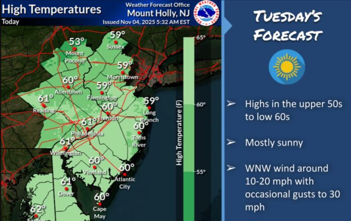
Tuesday and Wednesday are expected to feature breezy, dry weather. Afternoon temperatures will reach near 60 degrees, while overnight lows will dip into the 30s and 40s, with Tuesday night slightly colder than Wednesday night. Winds will shift from the northwest on Tuesday to the southwest on Wednesday, producing a crisp yet comfortable late-fall atmosphere.
Thursday brings the next low-pressure system, which is expected to track north of New Jersey, passing through New York State into southern New England. This system will deliver only minimal rainfall on the state’s southern edge, while northern areas remain largely dry. Friday should follow with cooler northwest winds and clear skies, briefly setting the stage for another low arriving Saturday morning. This system may track closer to northern New Jersey, producing more concentrated frontal rainfall that is likely to taper off by Saturday afternoon. Sunday will bring dry conditions, offering a brief respite before a potentially more significant weather pattern emerges early next week.
Looking ahead to Monday through Friday, November 10-14, meteorologists are monitoring a potent late-fall trough expected to bring the coldest air of the season so far. Overnight temperatures could drop to freezing across much of New Jersey, with northwestern elevations and inland locations most at risk. Coastal regions may remain slightly warmer, but the pattern signals a strong push of cold air across the state.
Atmospheric conditions include blocking over Greenland, a deep eastern U.S. trough, and a western U.S. ridge. This configuration increases the potential for wintry weather early next week. While a small upper-level low in the western U.S. may disrupt the formation of a major storm, models still indicate a chance for a mix of rain and light, disorganized snow, particularly around Tuesday, November 11. Snow accumulation would favor northwestern New Jersey elevations, while southern and coastal areas are more likely to experience rain due to warmer ocean and daytime temperatures. Historical events, such as the snowstorm following Halloween 2011 and the post-Sandy November 2012 storm, illustrate how rare perfect conditions are for early-season snow, making any accumulation this week a notable event.
For residents and visitors keeping an eye on local conditions, this week serves as a reminder that New Jersey weather in early November can be volatile, with multiple systems influencing temperature and precipitation in short succession. Those in northwest and inland areas should be prepared for the possibility of early frost and light snow, while the rest of the state may experience cool, mostly dry conditions punctuated by brief rain showers.
Weather enthusiasts looking for continuous updates and detailed forecasts for the Garden State can explore Explore New Jersey’s weather report section for ongoing tracking, maps, and analysis of emerging systems. Keeping tabs on these trends will be essential for residents planning travel, outdoor activities, or simply preparing for the first true taste of winter across New Jersey.


